30 March 2009
Toti Ramblers
401 Gordon House
Gordon Road
Amanzimtoti
4126
Walking update…
EMPISINI…
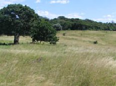
“The reserve was initiated in 1973 by the Umkomaas Centre of the Wildlife Society. Empisini means: “Place of the Hyena”, the name of the perennial stream which flows through the valley.” This is how the brochure describes the wonderful place where 15 Toti Ramblers meandered on Sunday last.
Thankfully we never encountered any Hyena, but the platoon of crab that escorted us into the Nature Reserve and the spiders that spun webs to ensnare us – kept us on the lookout during the entire walk.
While relaxing after the walk it was decided that the next walk would be at the Kenneth Stainbank Nature Reserve in Yellow-wood Park. I have contacted the people in charge of this reserve and they tell me that they have had a security problem. Apparently there is a young man who has accosted an elderly couple by knife-point and taken their possessions. He feels reasonably sure that a large group would come to no harm. If anyone has a problem though, you have been warned – this might be one walk that you would then like to miss. I will be there!
So, this walk will be taking place on Sunday 19 April 2009. They tell me that maps will be available at the gate – please grab one.
We will be walking – rain or shine – so look forward to seeing you all there.
As usual we will be meeting at Lords and Legends to organize the lift club between 08:15 and 08:30 – or meet at the gates at Kenneth Stainbank at 09:00.
Directions:
From Durban, take the N3 west and then the N2 south. Turn off the freeway at the Edwin Swales Drive/Queensburgh off-ramp, and turn left. After one kilometre, turn right at the Bellair Road intersection, and bear left along Cliffview Road . Turn left into Sarnia Road and then further along turn right into Coedmore Road at the second set of traffic lights. Continue along this road past the quarries, over the narrow bridge over the Umhlatuzana River , and up the hill until the gates to the reserve are seen on the right.
From Durban, take the N3 west and then the N2 south. Turn off the freeway at the Edwin Swales Drive/Queensburgh off-ramp, and turn left. After one kilometre, turn right at the Bellair Road intersection, and bear left along Cliffview Road . Turn left into Sarnia Road and then further along turn right into Coedmore Road at the second set of traffic lights. Continue along this road past the quarries, over the narrow bridge over the Umhlatuzana River , and up the hill until the gates to the reserve are seen on the right.
For those with GPS facilities the co-ordinates are:
Physical address: 90 Coedmore Avenue, Yellow-wood Park
GPS coordinates: 29 deg 54.79' S, 30 deg 56.51' E
GPS coordinates: 29 deg 54.79' S, 30 deg 56.51' E

No comments:
Post a Comment